
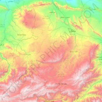
Samangan topographic map
Interactive map
Click on the map to display elevation.
About this map
Name: Samangan topographic map, elevation, terrain.
Location: Samangan, Afghanistan (35.34654 66.87595 36.64180 68.56788)
Average elevation: 1,885 m
Minimum elevation: 344 m
Maximum elevation: 4,040 m
Other topographic maps
Click on a map to view its topography, its elevation and its terrain.
Samangan
Afghanistan > Samangan > Samangan
Samangan, Aybak District, Samangan, Afghanistan
Average elevation: 1,347 m