
Shoe Lake topographic map
Interactive map
Click on the map to display elevation.
About this map
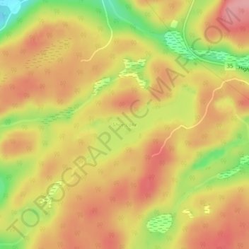
Name: Shoe Lake topographic map, elevation, terrain.
Average elevation: 385 m
Minimum elevation: 312 m
Maximum elevation: 429 m
Other topographic maps
Click on a map to view its topography, its elevation and its terrain.
Ril Lake
Canada > Ontario > Lake of Bays Township > Lake of Bays
Ril Lake, South Ril Lake Road, Lake of Bays Township, District Municipality of Muskoka, Muskoka District, Central Ontario, Ontario, Canada
Average elevation: 361 m