
Mazar-i-Sharif topographic map
Interactive map
Click on the map to display elevation.
About this map
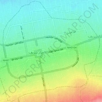
Name: Mazar-i-Sharif topographic map, elevation, terrain.
Location: Mazar-i-Sharif, Balkh, 1701, Afghanistan (36.68282 67.08289 36.73821 67.15313)
Average elevation: 367 m
Minimum elevation: 342 m
Maximum elevation: 417 m