
Baghlan Province topographic map
Interactive map
Click on the map to display elevation.
About this map
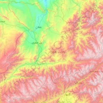
Name: Baghlan Province topographic map, elevation, terrain.
Location: Baghlan Province, Afghanistan (35.00373 68.00400 36.57457 69.97180)
Average elevation: 2,307 m
Minimum elevation: 407 m
Maximum elevation: 5,291 m
Other topographic maps
Click on a map to view its topography, its elevation and its terrain.
Puli Khumri
Afghanistan > Baghlan Province > Puli Khumri
Puli Khumri, Pul-e Khumri, Baghlan Province, Afghanistan
Average elevation: 935 m