
Tian Shan topographic map
Interactive map
Click on the map to display elevation.
About this map
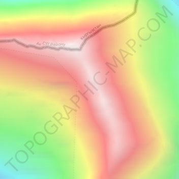
Name: Tian Shan topographic map, elevation, terrain.
Location: Tian Shan, Wensu County, Aksu Prefecture, Xinjiang, China (42.03089 80.20056 42.03099 80.20066)
Average elevation: 6,096 m
Minimum elevation: 5,160 m
Maximum elevation: 6,790 m
Continuous permafrost is typically found in the Tian Shan starting at the elevation of about 3,500-3,700 m above the sea level. Discontinuous alpine permafrost usually occurs down to 2,700-3,300 m, but in certain locations, due to the peculiarity of the aspect and the microclimate, it can be found at elevations as low as 2,000 m.
Other topographic maps
Click on a map to view its topography, its elevation and its terrain.
Tazhong
China > Xinjiang > Qarqan County > Tazhong Town
Tazhong, Tazhong Town, Qarqan County, Bayingolin, Xinjiang, China
Average elevation: 1,116 m
Keriya County
Keriya County, Hotan Prefecture, Xinjiang, 848400, China
Average elevation: 2,410 m
Yiwu County
Yiwu County, Hami, Yiwu, Xinjiang, China
Average elevation: 1,215 m
Kaba
China > Xinjiang > Habahe County > 阿克齐镇
Kaba, 阿克齐镇, Habahe County, Altay Prefecture, Xinjiang, China
Average elevation: 557 m
Korla
China > Xinjiang > Korla City
Korla, Korla City, Bayingolin, Xinjiang, 841000, China
Average elevation: 1,034 m
Awat
China > Xinjiang > Awat County
Awat, Awat County, Aksu Prefecture, Xinjiang, China
Average elevation: 1,046 m
Akto County
China > Xinjiang > Akto County
Akto County, Kizilsu Kirghiz Autonomous Prefecture, Xinjiang, China
Average elevation: 3,378 m
Khorgas Port
China > Xinjiang > Korgas City
Khorgas Port, Korgas City, Xinjiang, China
Average elevation: 796 m
Ürümqi County
Ürümqi County, Ürümqi, Xinjiang, 830000, China
Average elevation: 2,139 m
Ili Kazakh Autonomous Prefecture
Ili Kazakh Autonomous Prefecture, Xinjiang, China
Average elevation: 1,231 m
Hotan County
Hotan County, Hotan Prefecture, Xinjiang, China
Average elevation: 3,661 m