
Polk City topographic map
Interactive map
Click on the map to display elevation.
About this map
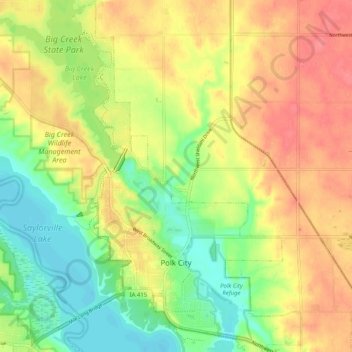
Name: Polk City topographic map, elevation, terrain.
Location: Polk City, Polk County, Iowa, 50226, United States (41.75202 -93.74393 41.82796 -93.67747)
Average elevation: 284 m
Minimum elevation: 250 m
Maximum elevation: 315 m
Other topographic maps
Click on a map to view its topography, its elevation and its terrain.
Des Moines
United States > Iowa > Polk County > Des Moines
Des Moines, Polk County, Iowa, 50319, United States
Average elevation: 271 m
Des Moines
United States > Iowa > Polk County
Des Moines, Polk County, Iowa, United States
Average elevation: 264 m
Clive
United States > Iowa > Polk County
Clive, Polk County, Iowa, 50325, United States
Average elevation: 287 m