
Lac Leclerc topographic map
Interactive map
Click on the map to display elevation.
About this map
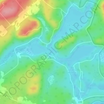
Name: Lac Leclerc topographic map, elevation, terrain.
Average elevation: 299 m
Minimum elevation: 266 m
Maximum elevation: 375 m
Other topographic maps
Click on a map to view its topography, its elevation and its terrain.
Mont Orford
Mont Orford, Orford, Memphrémagog, Estrie, Quebec, J1X 0R4, Canada
Average elevation: 563 m
Parc national du Mont-Orford
Parc national du Mont-Orford, L'Amanite, Orford, Memphrémagog, Estrie, Quebec, Canada
Average elevation: 336 m