
Wendover topographic map
Interactive map
Click on the map to display elevation.
About this map
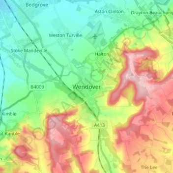
Name: Wendover topographic map, elevation, terrain.
Average elevation: 155 m
Minimum elevation: 81 m
Maximum elevation: 270 m
Other topographic maps
Click on a map to view its topography, its elevation and its terrain.
Buckland
United Kingdom > England > Wendover > Buckland
Buckland, Wendover, Buckinghamshire, South East, England, HP22 5HX, United Kingdom
Average elevation: 113 m