
Hot Springs topographic map
Interactive map
Click on the map to display elevation.
About this map
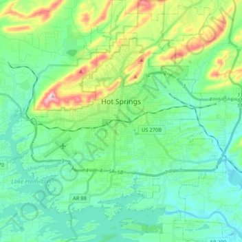
Name: Hot Springs topographic map, elevation, terrain.
Location: Hot Springs, Garland County, Arkansas, United States (34.42644 -93.12905 34.55940 -92.98510)
Average elevation: 172 m
Minimum elevation: 92 m
Maximum elevation: 420 m
Other topographic maps
Click on a map to view its topography, its elevation and its terrain.
Fountain Lake
United States > Arkansas > Garland County > Fountain Lake
Fountain Lake, Garland County, Arkansas, 71901, United States
Average elevation: 165 m