
Beresford Lake topographic map
Interactive map
Click on the map to display elevation.
About this map
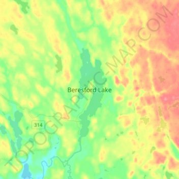
Name: Beresford Lake topographic map, elevation, terrain.
Location: Beresford Lake, Manitoba, Canada (50.83110 -95.28009 50.91110 -95.20009)
Average elevation: 327 m
Minimum elevation: 296 m
Maximum elevation: 360 m