
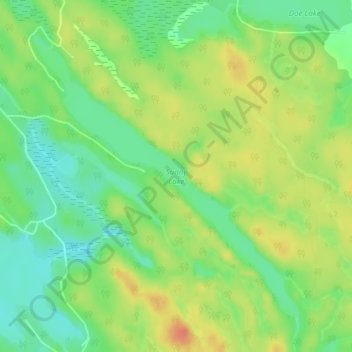
Sunny Lake topographic map
Interactive map
Click on the map to display elevation.
About this map
Name: Sunny Lake topographic map, elevation, terrain.
Average elevation: 264 m
Minimum elevation: 243 m
Maximum elevation: 287 m
Other topographic maps
Click on a map to view its topography, its elevation and its terrain.
Morrison Lake
Canada > Ontario > Gravenhurst
Morrison Lake, Long Point Road, Gravenhurst, District Municipality of Muskoka, Muskoka District, Central Ontario, Ontario, Canada
Average elevation: 223 m