
Greely topographic map
Interactive map
Click on the map to display elevation.
About this map
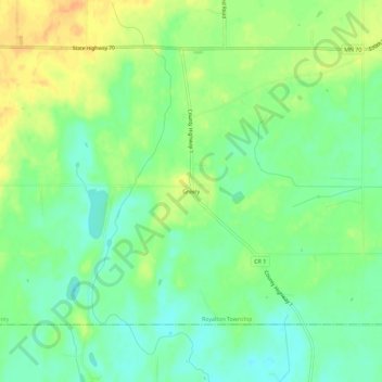
Name: Greely topographic map, elevation, terrain.
Location: Greely, Pine County, Minnesota, United States (45.72468 -93.08827 45.76468 -93.04827)
Average elevation: 292 m
Minimum elevation: 277 m
Maximum elevation: 310 m
Other topographic maps
Click on a map to view its topography, its elevation and its terrain.
Sandstone
United States > Minnesota > Pine County
Sandstone, Pine County, Minnesota, United States
Average elevation: 332 m
Finlayson
United States > Minnesota > Pine County
Finlayson, Pine County, Minnesota, United States
Average elevation: 339 m
Big Pine Lake
United States > Minnesota > Pine County
Big Pine Lake, Pine County, Minnesota, United States
Average elevation: 339 m
Willow River
United States > Minnesota > Pine County
Willow River, Pine County, Minnesota, United States
Average elevation: 319 m