
Lüderitz topographic map
Interactive map
Click on the map to display elevation.
About this map
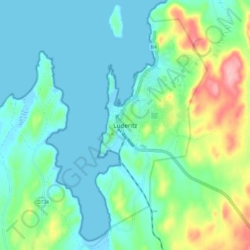
Name: Lüderitz topographic map, elevation, terrain.
Location: Lüderitz, Karas, Namibia (-26.69001 15.11727 -26.61001 15.19727)
Average elevation: 35 m
Minimum elevation: -2 m
Maximum elevation: 149 m