
Kilmar topographic map
Interactive map
Click on the map to display elevation.
About this map
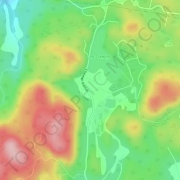
Name: Kilmar topographic map, elevation, terrain.
Average elevation: 284 m
Minimum elevation: 192 m
Maximum elevation: 398 m
Other topographic maps
Click on a map to view its topography, its elevation and its terrain.
Calumet
Canada > Quebec > Grenville-sur-la-Rouge
Calumet, Grenville-sur-la-Rouge, Argenteuil, Laurentides, Quebec, J0V 1B0, Canada
Average elevation: 86 m
Lac Grenville
Canada > Quebec > Grenville-sur-la-Rouge
Lac Grenville, Chemin Kilmar, Grenville-sur-la-Rouge, Argenteuil, Laurentides, Quebec, J0V 1B0, Canada
Average elevation: 281 m