
Oklahoma City topographic map
Interactive map
Click on the map to display elevation.
About this map
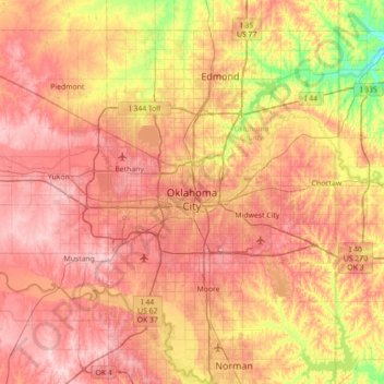
Name: Oklahoma City topographic map, elevation, terrain.
Location: Oklahoma City, Oklahoma County, Oklahoma, United States (35.29070 -97.83095 35.67487 -97.12472)
Average elevation: 362 m
Minimum elevation: 269 m
Maximum elevation: 434 m
Other topographic maps
Click on a map to view its topography, its elevation and its terrain.
Luther
United States > Oklahoma > Oklahoma County
Luther, Oklahoma County, Oklahoma, United States
Average elevation: 296 m