
Great Smoky Mountains National Park topographic map
Interactive map
Click on the map to display elevation.
About this map
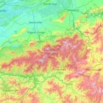
Name: Great Smoky Mountains National Park topographic map, elevation, terrain.
Average elevation: 765 m
Minimum elevation: 250 m
Maximum elevation: 2,012 m
Elevations in the park range from about 875 feet (267 m) to 6,643 feet (2,025 m) at the summit of Clingmans Dome. Within the park a total of sixteen mountains reach higher than 5,000 feet (1,520 m).