
Brady Lake topographic map
Interactive map
Click on the map to display elevation.
About this map
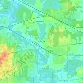
Name: Brady Lake topographic map, elevation, terrain.
Average elevation: 328 m
Minimum elevation: 312 m
Maximum elevation: 363 m
Other topographic maps
Click on a map to view its topography, its elevation and its terrain.
Streetsboro
United States > Ohio > Portage County
Streetsboro, Portage County, Ohio, 44241, United States
Average elevation: 335 m
Pritchard
United States > Ohio > Portage County
Pritchard, Paris Township, Portage County, Ohio, 44429, United States
Average elevation: 291 m