Sainte-Jeanne-d'Arc topographic map
Interactive map
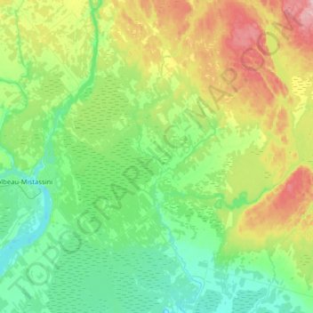
Click on the map to display elevation.
About this map
Name: Sainte-Jeanne-d'Arc topographic map, elevation, terrain.
Average elevation: 162 m
Minimum elevation: 98 m
Maximum elevation: 305 m

Click on the map to display elevation.
Name: Sainte-Jeanne-d'Arc topographic map, elevation, terrain.
Average elevation: 162 m
Minimum elevation: 98 m
Maximum elevation: 305 m