
Logone-et-Chari topographic map
Interactive map
Click on the map to display elevation.
About this map
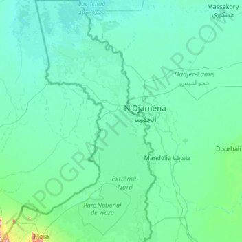
Name: Logone-et-Chari topographic map, elevation, terrain.
Location: Logone-et-Chari, Far-North, Cameroon (10.99910 14.08333 13.08333 15.14430)
Average elevation: 300 m
Minimum elevation: 277 m
Maximum elevation: 966 m