
Howe Island topographic map
Interactive map
Click on the map to display elevation.
About this map
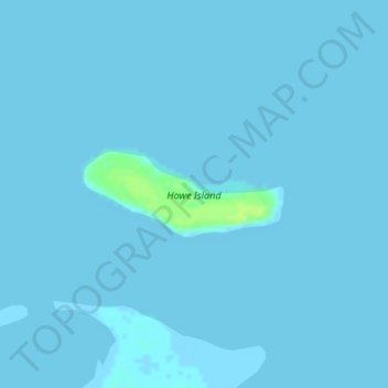
Name: Howe Island topographic map, elevation, terrain.
Location: Howe Island, North Slope, Alaska, United States (70.31232 -148.00347 70.31825 -147.96204)
Average elevation: 0 m
Minimum elevation: -1 m
Maximum elevation: 11 m
Other topographic maps
Click on a map to view its topography, its elevation and its terrain.
Oliktok Point
United States > Alaska > North Slope
Oliktok Point, North Slope, Alaska, United States
Average elevation: 0 m
Footprint Lake
United States > Alaska > North Slope > Utqiaġvik
Footprint Lake, Utqiaġvik, North Slope, Alaska, United States
Average elevation: 8 m
Point Barrow
United States > Alaska > North Slope
Point Barrow, North Slope, Alaska, United States
Average elevation: 0 m
Thunder Creek
United States > Alaska > North Slope
Thunder Creek, North Slope, Alaska, United States
Average elevation: 731 m
Wainwright
United States > Alaska > North Slope > Wainwright
Wainwright, North Slope, Alaska, 99782, United States
Average elevation: 3 m