
Tianshui topographic map
Interactive map
Click on the map to display elevation.
About this map
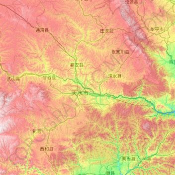
Name: Tianshui topographic map, elevation, terrain.
Location: Tianshui, Gansu, PRC (34.07839 104.57341 35.17684 106.71244)
Average elevation: 1,736 m
Minimum elevation: 805 m
Maximum elevation: 3,100 m
Other topographic maps
Click on a map to view its topography, its elevation and its terrain.