
Carbonton topographic map
Interactive map
Click on the map to display elevation.
About this map
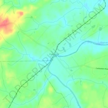
Name: Carbonton topographic map, elevation, terrain.
Average elevation: 85 m
Minimum elevation: 64 m
Maximum elevation: 132 m
Other topographic maps
Click on a map to view its topography, its elevation and its terrain.
Town of Pittsboro
United States > North Carolina > Chatham County > Town of Pittsboro
Town of Pittsboro, Chatham County, North Carolina, United States
Average elevation: 123 m