
Buchans topographic map
Interactive map
Click on the map to display elevation.
About this map
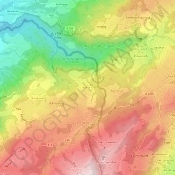
Name: Buchans topographic map, elevation, terrain.
Location: Buchans, Bezirk Bregenz, Vorarlberg, 6914, Austria (47.56064 9.80128 47.60064 9.84128)
Average elevation: 760 m
Minimum elevation: 486 m
Maximum elevation: 983 m