
Yankeetown topographic map
Interactive map
Click on the map to display elevation.
About this map
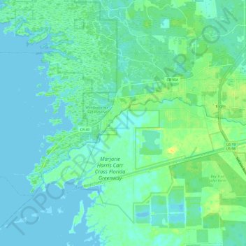
Name: Yankeetown topographic map, elevation, terrain.
Location: Yankeetown, Levy County, Florida, 34498, United States (28.99247 -82.81244 29.05373 -82.69127)
Average elevation: 6 m
Minimum elevation: -2 m
Maximum elevation: 21 m
Other topographic maps
Click on a map to view its topography, its elevation and its terrain.
Chiefland
United States > Florida > Levy County
Chiefland, Levy County, Florida, United States
Average elevation: 13 m
Cedar Key
United States > Florida > Levy County
Cedar Key, Levy County, Florida, United States
Average elevation: 2 m
Inglis
United States > Florida > Levy County
Inglis, Levy County, Florida, United States
Average elevation: 10 m