
Horn topographic map
Interactive map
Click on the map to display elevation.
About this map
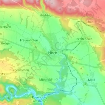
Name: Horn topographic map, elevation, terrain.
Location: Horn, Bezirk Horn, Lower Austria, 3580, Austria (48.62366 15.61631 48.70366 15.69631)
Average elevation: 349 m
Minimum elevation: 258 m
Maximum elevation: 525 m