
Kings Peak topographic map
Interactive map
Click on the map to display elevation.
About this map
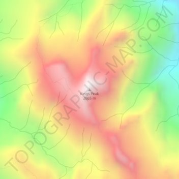
Name: Kings Peak topographic map, elevation, terrain.
Average elevation: 1,435 m
Minimum elevation: 724 m
Maximum elevation: 2,054 m
Other topographic maps
Click on a map to view its topography, its elevation and its terrain.
Wolf Mountain
Canada > British Columbia > Strathcona Regional District > Area D (Oyster Bay/Buttle Lake)
Wolf Mountain, Area D (Oyster Bay/Buttle Lake), Strathcona Regional District, British Columbia, Canada
Average elevation: 1,254 m
Oyster River
Canada > British Columbia > Strathcona Regional District > Area D (Oyster Bay/Buttle Lake) > Oyster River
Oyster River, Area D (Oyster Bay/Buttle Lake), Strathcona Regional District, British Columbia, V9J 1A0, Canada
Average elevation: 24 m
Arnica Lake
Canada > British Columbia > Strathcona Regional District > Area D (Oyster Bay/Buttle Lake)
Arnica Lake, Area D (Oyster Bay/Buttle Lake), Strathcona Regional District, British Columbia, Canada
Average elevation: 1,180 m
Flower Ridge
Canada > British Columbia > Strathcona Regional District > Area D (Oyster Bay/Buttle Lake)
Flower Ridge, Area D (Oyster Bay/Buttle Lake), Strathcona Regional District, British Columbia, Canada
Average elevation: 1,095 m