
Lock 22: Pennyfield Lock topographic map
Interactive map
Click on the map to display elevation.
About this map
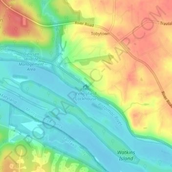
Name: Lock 22: Pennyfield Lock topographic map, elevation, terrain.
Average elevation: 73 m
Minimum elevation: 47 m
Maximum elevation: 107 m
Ground was broken for construction of the C&O Canal on July 4, 1828. One of the early plans was for the canal to be a way to connect the Chesapeake Bay with the Ohio River. The canal has several types of locks, including 74 lift locks necessary to handle a 608-foot (185 m) difference in elevation between the two ends of the canal—an average of about 8 feet (2.4 m) per lock. From Georgetown to Harpers Ferry, which includes Lock 22 (Pennyfield Lock), the canal is 60 feet (18 m) wide at the surface, and 42 feet (13 m) at the bottom. Including walls, lift locks are 100 feet (30 m) long and 15 feet (4.6 m) wide—usable lockage is less.