
Alma topographic map
Interactive map
Click on the map to display elevation.
About this map
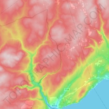
Name: Alma topographic map, elevation, terrain.
Location: Alma, Alma Parish, Albert County, New Brunswick, Canada (45.59950 -64.96964 45.71903 -64.88223)
Average elevation: 241 m
Minimum elevation: 0 m
Maximum elevation: 379 m
Other topographic maps
Click on a map to view its topography, its elevation and its terrain.
Square Lake
Canada > New Brunswick > Alma Parish > Alma
Square Lake, Alma, Alma Parish, Albert County, New Brunswick, Canada
Average elevation: 316 m