
Black River topographic map
Interactive map
Click on the map to display elevation.
About this map
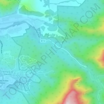
Name: Black River topographic map, elevation, terrain.
Location: Black River, 90608, Mauritius (-20.38988 57.37895 -20.36336 57.42783)
Average elevation: 129 m
Minimum elevation: 7 m
Maximum elevation: 635 m
Other topographic maps
Click on a map to view its topography, its elevation and its terrain.
Petite Rivière
Petite Rivière, Black River, Outer islands of Mauritius, Mauritius
Average elevation: 85 m