
Mansonville topographic map
Interactive map
Click on the map to display elevation.
About this map
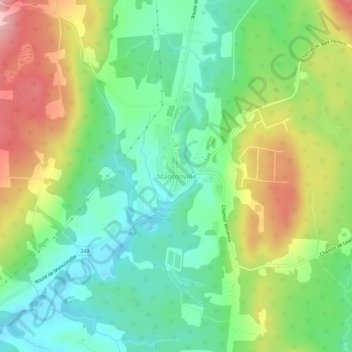
Name: Mansonville topographic map, elevation, terrain.
Average elevation: 211 m
Minimum elevation: 151 m
Maximum elevation: 309 m
Other topographic maps
Click on a map to view its topography, its elevation and its terrain.
Vale Perkins
Canada > Quebec > Memphrémagog > Potton
Vale Perkins, Potton, Memphrémagog, Estrie, Quebec, Canada
Average elevation: 287 m