
West Kelowna topographic map
Interactive map
Click on the map to display elevation.
About this map
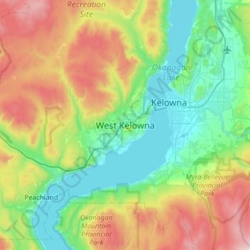
Name: West Kelowna topographic map, elevation, terrain.
Average elevation: 871 m
Minimum elevation: 335 m
Maximum elevation: 2,112 m
Other topographic maps
Click on a map to view its topography, its elevation and its terrain.
Mount Boucherie (West Face)
Canada > British Columbia > Regional District of Central Okanagan > West Kelowna
Mount Boucherie (West Face), West Kelowna, Regional District of Central Okanagan, British Columbia, V1Z 2T6, Canada
Average elevation: 506 m