
Erfurt topographic map
Interactive map
Click on the map to display elevation.
About this map
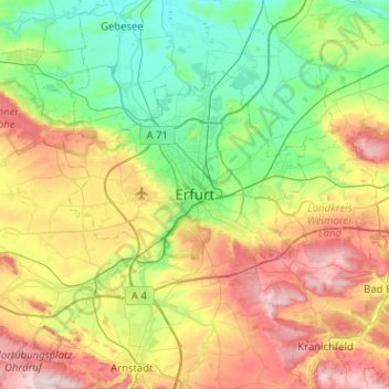
Name: Erfurt topographic map, elevation, terrain.
Location: Erfurt, Thuringia, 99084, Germany (50.81780 10.86874 51.13780 11.18874)
Average elevation: 272 m
Minimum elevation: 143 m
Maximum elevation: 511 m
Other topographic maps
Click on a map to view its topography, its elevation and its terrain.