
Le Salvage topographic map
Interactive map
Click on the map to display elevation.
About this map
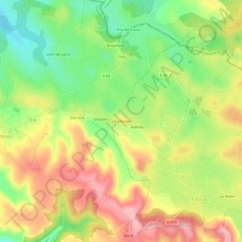
Name: Le Salvage topographic map, elevation, terrain.
Location: Le Salvage, Gourdon, Lot, Occitania, Metropolitan France, France (44.83483 1.71467 44.87483 1.75467)
Average elevation: 353 m
Minimum elevation: 280 m
Maximum elevation: 428 m