
Riverlea topographic map
Interactive map
Click on the map to display elevation.
About this map
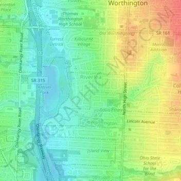
Name: Riverlea topographic map, elevation, terrain.
Location: Riverlea, Sharon Township, Franklin County, Ohio, USA (40.07722 -83.03137 40.08272 -83.01863)
Average elevation: 247 m
Minimum elevation: 225 m
Maximum elevation: 280 m