
Fort Dodge topographic map
Interactive map
Click on the map to display elevation.
About this map
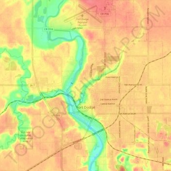
Name: Fort Dodge topographic map, elevation, terrain.
Location: Fort Dodge, Webster County, Iowa, 50501, United States (42.47256 -94.22433 42.55801 -94.11411)
Average elevation: 334 m
Minimum elevation: 292 m
Maximum elevation: 357 m
Other topographic maps
Click on a map to view its topography, its elevation and its terrain.
Gowrie
United States > Iowa > Webster County
Gowrie, Webster County, Iowa, United States
Average elevation: 347 m
Badger
United States > Iowa > Webster County
Badger, Webster County, Iowa, United States
Average elevation: 345 m