
Hyannis topographic map
Interactive map
Click on the map to display elevation.
About this map
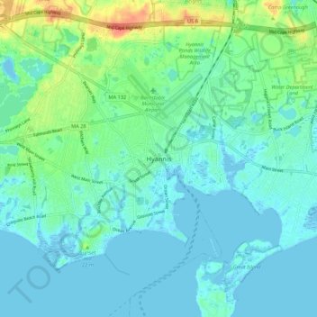
Name: Hyannis topographic map, elevation, terrain.
Location: Hyannis, Barnstable County, Massachusetts, 02601-5542, USA (41.63151 -70.30259 41.67151 -70.26259)
Average elevation: 7 m
Minimum elevation: -4 m
Maximum elevation: 23 m