
Stare Miasto topographic map
Interactive map
Click on the map to display elevation.
About this map
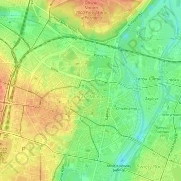
Name: Stare Miasto topographic map, elevation, terrain.
Location: Stare Miasto, Poznań, Greater Poland Voivodeship, Poland (52.39809 16.91091 52.42109 16.94657)
Average elevation: 68 m
Minimum elevation: 45 m
Maximum elevation: 88 m