
North York Moors National Park topographic map
Interactive map
Click on the map to display elevation.
About this map
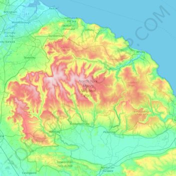
Name: North York Moors National Park topographic map, elevation, terrain.
Average elevation: 110 m
Minimum elevation: -3 m
Maximum elevation: 449 m