
Estes Park topographic map
Interactive map
Click on the map to display elevation.
About this map
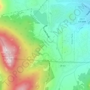
Name: Estes Park topographic map, elevation, terrain.
Location: Estes Park, Larimer County, Colorado, USA (40.33115 -105.53675 40.34158 -105.52449)
Average elevation: 2,543 m
Minimum elevation: 2,354 m
Maximum elevation: 2,897 m