
Worley topographic map
Interactive map
Click on the map to display elevation.
About this map
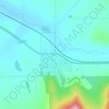
Name: Worley topographic map, elevation, terrain.
Location: Worley, Kootenai County, Idaho, United States (47.39512 -116.92215 47.40602 -116.91275)
Average elevation: 830 m
Minimum elevation: 791 m
Maximum elevation: 1,030 m
Worley is located at 47°23′57″N 116°55′10″W / 47.39917°N 116.91944°W / 47.39917; -116.91944 (47.399124, -116.919410), at an elevation of 2,661 feet (811 m) above sea level.