
Seragude topographic map
Interactive map
Click on the map to display elevation.
About this map
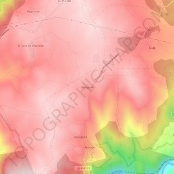
Name: Seragude topographic map, elevation, terrain.
Location: Seragude, Tierra de Lemos, Lugo, Galicia, 27437, España (42.44015 -7.68900 42.48015 -7.64900)
Average elevation: 575 m
Minimum elevation: 165 m
Maximum elevation: 692 m