
Rainier topographic map
Interactive map
Click on the map to display elevation.
About this map
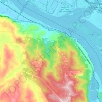
Name: Rainier topographic map, elevation, terrain.
Location: Rainier, Columbia County, Oregon, United States (46.04008 -122.98031 46.10909 -122.90296)
Average elevation: 123 m
Minimum elevation: -5 m
Maximum elevation: 358 m
Other topographic maps
Click on a map to view its topography, its elevation and its terrain.
Yankton
United States > Oregon > Columbia County
Yankton, Columbia County, Oregon, United States
Average elevation: 111 m