
Andrate topographic map
Interactive map
Click on the map to display elevation.
About this map
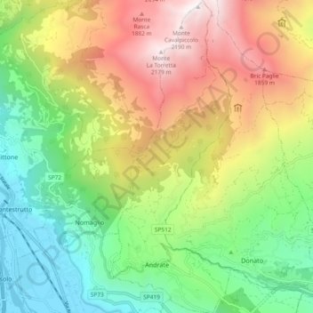
Name: Andrate topographic map, elevation, terrain.
Location: Andrate, Provincia di Torino, Piemont, Italy (45.51721 7.86630 45.58222 7.90240)
Average elevation: 1,059 m
Minimum elevation: 249 m
Maximum elevation: 2,220 m
Andrate borders the following municipalities: Settimo Vittone, Donato, Nomaglio, Borgofranco d'Ivrea, and Chiaverano. It is located at the top of the Moraine of Ivrea, with elevations ranging from 550 to 2,227 meters above the sea level.