
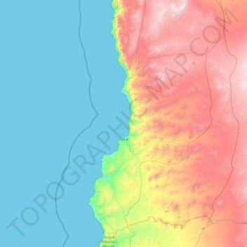
Taltal topographic map
Interactive map
Click on the map to display elevation.
About this map
Name: Taltal topographic map, elevation, terrain.
Average elevation: 865 m
Minimum elevation: 0 m
Maximum elevation: 3,048 m
Other topographic maps
Click on a map to view its topography, its elevation and its terrain.
Atacama Desert
Chile > Antofagasta Region > Provincia de Antofagasta > Antofagasta
Atacama Desert, Antofagasta, Provincia de Antofagasta, Antofagasta Region, Chile
Average elevation: 1,961 m
Cerro Pereda
Chile > Antofagasta Region > Provincia de Antofagasta > Taltal
Cerro Pereda, Taltal, Provincia de Antofagasta, Antofagasta Region, Chile
Average elevation: 4,246 m
Antofagasta
Chile > Antofagasta Region > Provincia de Antofagasta
Antofagasta, Provincia de Antofagasta, Antofagasta Region, Chile
Average elevation: 952 m