
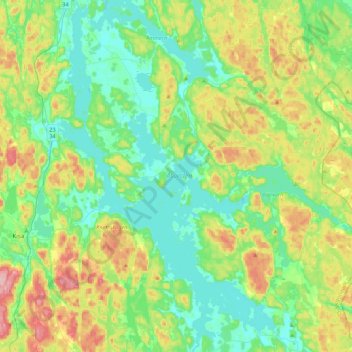
Åsunden topographic map
Interactive map
Click on the map to display elevation.
About this map
Name: Åsunden topographic map, elevation, terrain.
Average elevation: 135 m
Minimum elevation: 81 m
Maximum elevation: 262 m
Other topographic maps
Click on a map to view its topography, its elevation and its terrain.
Kisa
Sweden > Östergötland County > Kisa
Kisa, Kinda kommun, Östergötland County, Region Götaland, 59037, Sweden
Average elevation: 155 m
Ydrefors
Sweden > Östergötland County > Ydrefors
Ydrefors, Kinda kommun, Östergötland County, Region Götaland, 59873, Sweden
Average elevation: 188 m
Sätravallen
Sweden > Östergötland County > Bestorp
Sätravallen, E 689, Vårdnäs, Bestorp, Linköpings kommun, Province Östergötland, Östergötland County, Region Götaland, 589 65, Sweden
Average elevation: 113 m