
Rivière Missisquoi topographic map
Interactive map
Click on the map to display elevation.
About this map
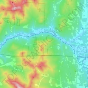
Name: Rivière Missisquoi topographic map, elevation, terrain.
Average elevation: 371 m
Minimum elevation: 150 m
Maximum elevation: 991 m
Other topographic maps
Click on a map to view its topography, its elevation and its terrain.
Glen Sutton
Canada > Québec > Sutton > Glen Sutton
Glen Sutton, Sutton, Brome-Missisquoi, Montérégie, Québec, Canada
Average elevation: 272 m
Mont Gagnon
Mont Gagnon, Sutton, Brome-Missisquoi, Montérégie, Québec, J0E2K0, Canada
Average elevation: 672 m