
Westbridge topographic map
Interactive map
Click on the map to display elevation.
About this map
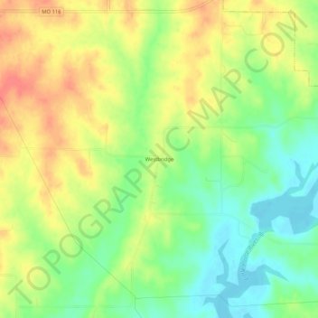
Name: Westbridge topographic map, elevation, terrain.
Location: Westbridge, Clinton County, Missouri, 64477, United States (39.51944 -94.52079 39.55944 -94.48079)
Average elevation: 291 m
Minimum elevation: 263 m
Maximum elevation: 319 m