
Senzeille topographic map
Interactive map
Click on the map to display elevation.
About this map
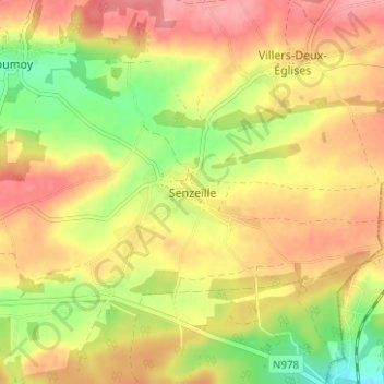
Name: Senzeille topographic map, elevation, terrain.
Average elevation: 249 m
Minimum elevation: 196 m
Maximum elevation: 289 m
Altitude au seuil de l’église. 253 m. Le plus haut point près de la taille Gosset suivant la carte ING de Senzeilles. 295 m.