
Lantier topographic map
Interactive map
Click on the map to display elevation.
About this map
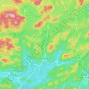
Name: Lantier topographic map, elevation, terrain.
Location: Lantier, Les Laurentides, Laurentides, Quebec, Canada (46.11469 -74.32051 46.21648 -74.19969)
Average elevation: 461 m
Minimum elevation: 364 m
Maximum elevation: 674 m