
江南区 topographic map
Interactive map
Click on the map to display elevation.
About this map
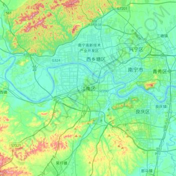
Name: 江南区 topographic map, elevation, terrain.
Location: 江南区, Jiangnan District, Nanning City, Guangxi, China (22.62315 108.11370 22.94315 108.43370)
Average elevation: 125 m
Minimum elevation: 59 m
Maximum elevation: 367 m